Click to see more because I’ve not only posted a transcript and piece of old map, I’ve got some extracts from documents about this trail dating from the 1930s and 1940s.
Although I usually ski Trail #8 starting from Kingsmere, this historic trail was usually accessed by Ottawa Ski Club Members from their base at Camp Fortune, so I’ll tell you about what was Scottish about this Highland trail starting from the north-western end.
 Click map to see full size.
The creator of the trail wasn’t Scottish at all. He was the famous trail builder Joe Morin.
But the rocky terrain of Gatineau Park reminded those skiers of 1930 of the Scottish Highlands; either that or they did a lot of drinking as they worked, based on the whiskey-related names of some of the trail features.
Moving south along #8 from Ridge Road the first big downhill was once known as Doch and Doris. This is an expression from Gaelic that refers to that last drink before you go; it literally means “drink at the door.”
There was a popular song by this name; here’s a video of it.
The modern trail edges very close to the Champlain Parkway before climbing up to a corner that once had a great view of the Ottawa Valley and was named Old Man Joe’s Lookout; after the trail’s creator.
The trail then heads east and the next little downhill also relates to drinking; it was known as A Wee Drop.
There still is a lookout at the big rock just east of there and that lookout was known as King or Kingsmere Lookout and looks out at King Mountain.
Continuing toward Kingsmere there is a long hill once known as the Highland Fling. In the 1930s the Highland Fling ended at the base of the first big descent but by the 1950s was considered to extend all the way to where a house has now been built in a stream valley once known as Glen McTavish.
At the time there was no Champlain Parkway and the exact route of now trail #8 down this valley could possibly follow what was George’s Trail way back when.
Extract from the 1930-31 edition of Canadian Ski-ing:
Captain Joe Morin, with a detail of hardy Gatineau pioneers, each and everyone of whom swings a wicked axe, conducted his annual fall offensive against the volunteer growth that each year threatens to encroach on our trails and clearings. Old routes were cleared out, bridges and culverts built, corners rounded and banked and hips and hollows cut and filled… A new route to the west of Camp Fortune, called the Highland trail which includes the Highland Fling, the Haggis, and other typical Caledonian features, proved immensely popular with the daredevil element.
Extract from the 1943 Ottawa Ski Club Guide:
Hoot mon! If ye hae a drappie O’ Scots blood in your veins ye dinna want to miss this trail. ‘Twill remind ye O’ the clear auld heather hills and misty glens O’ Bonnie Scotland, and faintly in your ears you’ll hear the haunting strains O’ the pibroch! [According to the OED “pibroch: A type of music for the Scottish bagpipes “ or more rarely bagpipes themselves.] But even if you are a Sassenach of the deepest dye, [Again from the OED “Sassenach: The name given by the Gaelic inhabitants of Great Britain and Ireland to their ‘Saxon’ or English neighbours.”] the rugged rugged beauty of this terrain will hold you spellbound.
Surely this was a playground of the gods when the Ice Age was slowly releasing the ancient Laurentians from its cold grasp! You can see where they ripped the mountains apart just for the fun of it, leaving gaping chasms and precipitous walls of sheer rock. Huge boulders weighing tons lie strewn at the side of the trail where the gods left them after a game of duck-on-the-rock. The majestic grandeur of it all brings a feeling of awe and wonder to man, and his imagination runs riot …
But enough of wordy descriptions. You will be anxious to know how to reach this hinterlandof natural beauty.
Take the trail up Bonnie Brae [an unrelated Scottish reference] – the same as for the Merry-go-round [now trail #11] but just ignore the Horse Race and continue straight ahead. Soon you will find yourself on a twisty little hill that cuts across the Ridge road and enters a pine grove. This is the start of the Highland trail.
It might be mentioned here that this trail, despite its Scottish place-names, was laid out by Capt. Joe Morin, a French Canadian. Capt. Morin who was last heard of in Florida (in the footsteps of Ponce de Leon?[the first European in Florida]) will be long remembered for his yeoman service in trail-cutting as well as for his founding that noble band of volunteers known as the Night Riders.
After picking your way through a ragged “bad lands” of stumps, all the woodcutters left of a noble pine brush, you come to the Doch and Doris. This is a lovely run with a pause in the middle just before a sharp left turn. The trail then winds upwards around the mountain until suddenly you find yourself at Old Man Joe’s lookout. Standing here with one foot on a cloud you can see a wide arc of the countryside including Aylmer and Constance Bay. On a clear day it’s a magnificent sight.
Soon afterwards you descend A Wee Drop. There is more steep climbing, then Kingsmere lookout. Here you can see King’s Mountain straight across and Black Lake straight down. It is hard to say how great the drop is to the lake, but I’d say the rock that tops the lookout would be an excellent take-off for parachute jumpers.
Now is the time to see that all your trappings and accoutrement are secure, for you are now at the top of the famous Highland Fling. This is the appropriate name given to a series of zig-zag runs where you descend three or four hundred feet in about a third of a mile. And if you never
before sympathized with John Gilpin [a literary character who’s horse ran away with him 10 miles to the next town], you will after this. Once you push off there are no stops. Of course, it has been known for skiers to stop for a rest a couple of times on the way down. You may get it glimpse of them lying here and there in the snow as you hurry along. But this is pure laziness, and is not to be recommended.
When you gradually come to a stop you are where George’s trail converges, right behind Grime’s hill This is the end of the Highland. If you want to return to Camp Fortune you can climb back George’s or take the first trail left and continue on the Lower Highland and back in by the Canyon, but this is much longer. But perhaps you are homeward bound. In that case proceed down Grimes’ to Kingsmere road where you have the choice of going back to Old Chelsea for a bus or taking the Pink Lake trail to Wrightville.
- J.S.P. (Highland trail: length approx. 2 miles, time ¾ to 1¼ hours.)
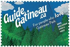 The cards that GuideGatineau has begun distributing to promote the website are considered to be highly environmentally responsible due to the fact that the paper used is 100% recycled and is produced using energy from biofuels plus the ink is vegetable based.